Parc des Bruyères – Marseille 10e Arrondissement
Description
English
Deutsch
Dutch
Español
Italiano
Description
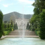
Situé entre les quartiers de Saint-Loup, Saint-Marcel et le Mont de Carpiagne, le parc des Bruyères a été conçu sur une propriété de 101 hectares, rachetée par la ville, en 1980. En limite de zone urbaine, il occupe les deux versants du vallon de l'Evêque et constitue une charnière verte entre les quartiers est et les calanques. Son relief est caractéristique par ses variations d'altitude s'échelonnant entre 120 et 570 mètres. Sa végétation endémique est constituée d'espèces arbustives remarquables (cistes, arbousiers…) et en particulier, la bruyère Erica arborea qui a inspiré le nom du site. Très prisé des randonneurs et excursionnistes, il offre un point de départ dans le massif de Saint-Cyr, ainsi qu'une balade culturelle de découverte de vestiges anciens (fours à chaux, terrasses de culture d'oliviers, anciennes bergeries…).
English
In some squares, the playgrounds can still be used but are under the responsibility of the parents who must ensure that the sanitary rules are respected and, in particular, that the children are physically distanced. Located between the districts of Saint-Loup, Saint-Marcel and Mont de Carpiagne, the Parc des Bruyères was designed on a 101-hectare property, purchased by the city in 1980. On the edge of the urban area, it occupies both sides of the Evêque valley and constitutes a green hinge between the eastern districts and the calanques. Its relief is characteristic by its altitude variations ranging between 120 and 570 meters. Its endemic vegetation is made up of remarkable shrub species (rockrose, arbutus…) and in particular, the Erica arborea heather which inspired the name of the site. Very popular with hikers and excursionists, it offers a starting point in the massif of Saint-Cyr, as well as a cultural stroll to discover ancient vestiges (lime kilns, olive tree cultivation terraces, ancient sheepfolds…). In 2006, the municipality joined forces with the Conseil Général and other site managers to inform users about fire hazards and the opening of reception areas in the massifs: a single telephone number to find out everything from July 1 to September 9: 0811 20 13 13 (cost of a local call).
Deutsch
Der Parc des Bruyères liegt zwischen den Stadtteilen Saint-Loup, Saint-Marcel und Mont de Carpiagne und wurde auf einem 101 Hektar großen Grundstück angelegt, das 1980 von der Stadt aufgekauft wurde. Am Rande des Stadtgebiets nimmt er die beiden Hänge des Vallon de l'Evêque ein und bildet ein grünes Scharnier zwischen den östlichen Stadtvierteln und den Calanques. Sein Relief ist durch seine Höhenunterschiede charakteristisch, die zwischen 120 und 570 Metern liegen. Seine endemische Vegetation besteht aus bemerkenswerten Straucharten (Zistrosen, Erdbeerbäume…) und insbesondere aus dem Heidekraut Erica arborea, das den Namen des Ortes inspiriert hat. Er ist bei Wanderern und Ausflüglern sehr beliebt und bietet einen Ausgangspunkt im Massif de Saint-Cyr sowie einen kulturellen Spaziergang zur Entdeckung alter Überreste (Kalköfen, Terrassen für den Anbau von Olivenbäumen, alte Schäfereien…).
Dutch
Het Parc des Bruyères, gelegen tussen de wijken Saint-Loup, Saint-Marcel en Mont de Carpiagne, werd ontworpen op een eigendom van 101 hectare dat in 1980 door de stad werd aangekocht. Het grenst aan het stedelijk gebied en ligt aan weerszijden van de vallei van de Evêque. Het vormt een groene scharnier tussen de oostelijke wijken en de calanques. Het reliëf wordt gekenmerkt door hoogteverschillen van 120 tot 570 meter. De endemische vegetatie bestaat uit opmerkelijke struiksoorten (cistus, arbutus, enz.) en in het bijzonder de Erica arborea heide, die de inspiratie vormde voor de naam van de site. Een populaire bestemming voor wandelaars en dagjesmensen, het biedt een vertrekpunt in het Saint-Cyr massief, maar ook een culturele wandeling om oude overblijfselen te ontdekken (kalkovens, olijventeelt terrassen, oude schaapskooien, enz.)
Español
Situado entre los distritos de Saint-Loup, Saint-Marcel y Mont de Carpiagne, el Parque des Bruyères fue diseñado en una propiedad de 101 hectáreas adquirida por la ciudad en 1980. Bordeando la zona urbana, ocupa las dos orillas del vallon de l'Evêque, formando una bisagra verde entre los barrios del este y las calanques. Su relieve se caracteriza por variaciones de altitud que van de 120 a 570 metros. Su vegetación endémica se compone de notables especies arbustivas (jaras, madroños, etc.) y, en particular, del brezo Erica arborea, que inspiró el nombre del lugar. Destino popular para excursionistas y excursionistas de un día, ofrece un punto de partida en el macizo de Saint-Cyr, así como un paseo cultural para descubrir antiguos vestigios (hornos de cal, terrazas de cultivo de olivos, antiguos apriscos, etc.).
Italiano
Situato tra i quartieri di Saint-Loup, Saint-Marcel e Mont de Carpiagne, il Parco delle Bruyères è stato progettato su una proprietà di 101 ettari acquistata dalla città nel 1980. Confinante con l'area urbana, occupa entrambi i lati del vallon de l'Evêque, formando una cerniera verde tra i quartieri orientali e le calanques. Il suo rilievo è caratterizzato da variazioni di altitudine che vanno dai 120 ai 570 metri. La sua vegetazione endemica è costituita da notevoli specie arbustive (cisto, corbezzolo, ecc.) e in particolare dall'Erica arborea, che ha ispirato il nome del sito. Meta di escursionisti e gitanti, offre un punto di partenza per il massiccio di Saint-Cyr e una passeggiata culturale alla scoperta di antiche vestigia (fornaci per la calce, terrazzamenti per la coltivazione dell'olivo, antichi ovili, ecc.)
Equipements: Aire de jeux, terrain de jeux extérieurs - Aire de pique-nique - Parking à proximité
45 rue des Trois Ponts, 13010 Marseille 10e Arrondissement

Crédits: Parc des Bruyères - Ville de Marseille