Site de decollage parapente – la sotiere – Sapois
Description
English
Deutsch
Dutch
Español
Italiano
Description
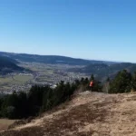
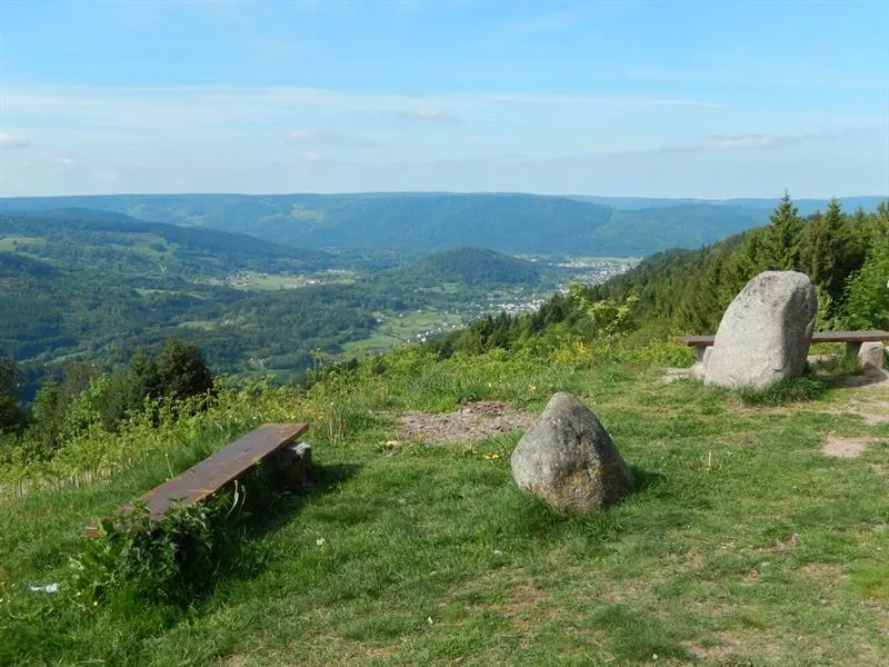
Au Haut du Tôt, la Sotière offre un site de décollage pour les parapentistes expérimentés et possédant leur propre matériel. Accès Depuis Vagney centre, prendre la direction de Sapois. A la sortie du village, tourner à gauche vers le Haut du Tôt. Puis, au lieu-dit Le Poteau, prendre sur la droite la route qui conduit à la Sotière. Le site de décollage se situe sous le relais de la Sotière (parking à 3 min). Descriptions et recommandations Altitude : 920 m. Orientation : S.E. Type de décollage : prairie. Balise météo : la Sotière.
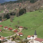
Atterrissage : vallée de Sapois (alt. 450 m). Toujours atterrir dans un pré fauché dans la vallée. Attention aux lignes électriques. Avant tout vol, le club de vol libre local, Les Counailles, recommande de prendre contact avec ses pilotes car ce site est techniquement difficile. Contact : 03 29 61 27 77 ou 06 02 04 32 92. Pour en savoir plus : http://federation.ffvl.fr/sites_pratique/voir/1566
English
At the Haut du Tôt, La Sotière offers a launch site for experienced paragliders with their own equipment. Access From Vagney centre, take the direction of Sapois. At the exit of the village, turn left towards Haut du Tôt. Then, at Le Poteau, turn right onto the road leading to La Sotière. The take-off site is located under the Relais de la Sotière (parking at 3 min) Descriptions and recommendations Altitude: 920 m. Orientation : S.E. Take-off type : grassland. Weather beacon : la Sotière.
Landing : Sapois valley (alt. 450 m). Always land in a mowed meadow in the valley. Beware of power lines Before any flight, the local free flight club, Les Counailles, recommends to contact its pilots as this site is technically difficult. Contact: 03 29 61 27 77 or 06 02 04 32 92. For more information: http://federation.ffvl.fr/sites_pratique/voir/1566
Deutsch
In Haut du Tôt bietet die Sotière einen Startplatz für erfahrene Gleitschirmflieger mit eigener Ausrüstung. Zugang Von Vagney Zentrum aus fahren Sie in Richtung Sapois. Am Ortsausgang biegen Sie links in Richtung Haut du Tôt ab. Dann im Ort Le Poteau rechts auf die Straße abbiegen, die nach La Sotière führt. Der Startplatz befindet sich unterhalb des Relais de la Sotière (Parkplatz 3 min entfernt) Beschreibungen und Empfehlungen Höhe: 920 m. Orientierung: S.E. Art des Startplatzes: Wiese. Wetterstation: La Sotière.
Landung: Tal von Sapois (alt. 450 m). Landen Sie immer auf einer gemähten Wiese im Tal. Achten Sie auf Stromleitungen Vor jedem Flug empfiehlt der örtliche Freiflugverein Les Counailles, sich mit seinen Piloten in Verbindung zu setzen, da dieser Ort technisch schwierig ist. Kontakt: 03 29 61 27 77 oder 06 02 04 32 92. Weitere Informationen: http://federation.ffvl.fr/sites_pratique/voir/1566
Dutch
In Haut du Tôt biedt de Sotière een lanceerplaats voor ervaren paragliders met eigen materiaal. Toegang Vanuit het centrum van Vagney neemt u de richting van Sapois. Aan het eind van het dorp linksaf richting Haut du Tôt. Neem vervolgens bij de plaats Le Poteau de weg rechts die naar La Sotière leidt. Het opstijgterrein bevindt zich onder het relaisstation van Sotière (parkeerplaats op 3 minuten afstand) Beschrijvingen en aanbevelingen Hoogte: 920 m. Richting: Z.O. Type opstijging: weiland. Weerbaken: la Sotière.
Landing: vallei van de Sapois (hoogte 450 m). Landen altijd in een gemaaide weide in de vallei. Pas op voor elektriciteitskabels Voor elke vlucht raadt de plaatselijke vrije vluchtclub, Les Counailles, aan om contact op te nemen met de piloten, aangezien dit terrein technisch moeilijk is. Contact: 03 29 61 27 77 of 06 02 04 32 92. Voor meer informatie: http://federation.ffvl.fr/sites_pratique/voir/1566
Español
En Haut du Tôt, la Sotière ofrece un lugar de despegue para parapentistas experimentados con su propio equipo. Acceda a Desde el centro de Vagney, tome la dirección de Sapois. Al final del pueblo, gire a la izquierda hacia Haut du Tôt. Luego, en el lugar llamado Le Poteau, tome la carretera de la derecha que lleva a La Sotière. El lugar de despegue se encuentra bajo la estación de relevo de Sotière (aparcamiento a 3 minutos) Descripciones y recomendaciones Altitud: 920 m. Dirección: S.E. Tipo de despegue: pradera. Faro meteorológico: la Sotière.
Aterrizaje: valle de Sapois (altitud 450 m). Siempre aterriza en un prado segado en el valle. Cuidado con las líneas eléctricas Antes de cualquier vuelo, el club local de vuelo libre, Les Counailles, recomienda ponerse en contacto con sus pilotos, ya que este sitio es técnicamente difícil. Contacto: 03 29 61 27 77 o 06 02 04 32 92. Para más información: http://federation.ffvl.fr/sites_pratique/voir/1566
Italiano
All'Haut du Tôt, la Sotière offre un sito di lancio per parapendisti esperti con attrezzatura propria. Accesso Dal centro di Vagney, prendere la direzione di Sapois. Alla fine del villaggio, svoltare a sinistra in direzione Haut du Tôt. Poi, in località Le Poteau, prendere la strada a destra che porta a La Sotière. Il sito di decollo si trova sotto la stazione di staffetta di Sotière (parcheggio a 3 minuti di distanza) Descrizioni e raccomandazioni Altitudine: 920 m. Direzione: S.E. Tipo di decollo: prato. Faro meteorologico: la Sotière.
Atterraggio: valle di Sapois (alt. 450 m). Atterraggio sempre in un prato falciato nella valle. Attenzione alle linee elettriche Prima di qualsiasi volo, il club di volo libero locale, Les Counailles, raccomanda di contattare i suoi piloti, poiché questo sito è tecnicamente difficile. Contatto: 03 29 61 27 77 o 06 02 04 32 92. Per maggiori informazioni: http://federation.ffvl.fr/sites_pratique/voir/1566
Sport aérien - Parapente - Paramoteur
Route de la Sotière, 88120 Sapois
Crédits: BIT VAGNEY