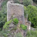
Randonnée – Autour du château de Roumégous – La Salvetat-Peyralès
Description
English
Deutsch
Dutch
Español
Italiano
Description
Distance: 16.5 km – Dénivelé positif: 700 m – Durée: 6h Rejoindre le centre du bourg de La Salvetat Peyralès (D905, Rieupeyroux, Carmaux).
Parking : Place de l'ancien foirail près de la salle des fêtes.
Balisage : Jaune
Les topoguides sont en vente à l'office de tourisme avec les étapes, des informations sur les lieux de visites ainsi que quelques anecdotes historiques.
Retrouvez tous nos circuits sur votre smartphone avec l'application Cirkwi, ou avec un lecteur GPX (ex. GPX viewer) :
https://www.cirkwi.com/fr/circuit/68668-randonnee-autour-du-chateau-de-roumegous
English
Distance: 16.5 km – Ascent: 700 m – Duration: 6h Reach the center of the village of La Salvetat Peyralès (D905, Rieupeyroux, Carmaux).
Parking: Place de l'ancien foirail near the village hall.
Marking: Yellow
Topoguides are on sale at the tourist office, with stages, information on places to visit and a few historical anecdotes.
Find all our tours on your smartphone with the Cirkwi application, or with a GPX reader (e.g. GPX viewer):
https://www.cirkwi.com/fr/circuit/68668-randonnee-autour-du-chateau-de-roumegous
Deutsch
Distanz: 16.5 km – Positiver Höhenunterschied: 700 m – Dauer: 6 Stunden Fahren Sie zum Zentrum des Dorfes La Salvetat Peyralès (D905, Rieupeyroux, Carmaux).
Parkplatz: Place de l'ancienne foirail in der Nähe des Festsaals.
Markierung: Gelb
Im Tourismusbüro sind Topoguides erhältlich, die die Etappen, Informationen zu den Sehenswürdigkeiten sowie einige historische Anekdoten enthalten.
Finden Sie alle unsere Touren auf Ihrem Smartphone mit der Cirkwi-App oder mit einem GPX-Leser (z. B. GPX viewer) :
https://www.cirkwi.com/fr/circuit/68668-randonnee-autour-du-chateau-de-roumegous
Dutch
Afstand: 16,5 km – Stijging: 700 m – Duur: 6u Ga naar het centrum van het dorp La Salvetat Peyralès (D905, Rieupeyroux, Carmaux).
Parkeerplaats: Place de l'ancien foirail bij het dorpshuis.
Markering: Geel
Bij het toeristenbureau zijn topogidsen te koop met routebeschrijvingen, informatie over bezienswaardigheden en enkele historische anekdotes.
Je kunt al onze routes vinden op je smartphone met de applicatie Cirkwi, of met een GPX-lezer (bijv. GPX viewer):
https://www.cirkwi.com/fr/circuit/68668-randonnee-autour-du-chateau-de-roumegous
Español
Distancia: 16,5 km – Ascenso: 700 m – Duración: 6h Ir al centro del pueblo de La Salvetat Peyralès (D905, Rieupeyroux, Carmaux).
Aparcamiento: Place de l'ancien foirail cerca del ayuntamiento.
Señalización: amarillo
En la oficina de turismo se venden topoguías con indicaciones sobre las etapas, información sobre los lugares a visitar y algunas anécdotas históricas.
Puede encontrar todas nuestras rutas en su smartphone utilizando la aplicación Cirkwi, o con un lector GPX (por ejemplo, GPX viewer):
https://www.cirkwi.com/fr/circuit/68668-randonnee-autour-du-chateau-de-roumegous
Italiano
Distanza: 16,5 km – Salita: 700 m – Durata: 6h Raggiungere il centro del villaggio di La Salvetat Peyralès (D905, Rieupeyroux, Carmaux).
Parcheggio: Place de l'ancien foirail vicino al municipio.
Segnaletica: giallo
Presso l'ufficio del turismo sono in vendita le Topoguide, con indicazioni sulle tappe, informazioni sui luoghi da visitare e qualche aneddoto storico.
Potete trovare tutti i nostri percorsi sul vostro smartphone utilizzando l'applicazione Cirkwi o con un lettore GPX (ad esempio GPX viewer):
https://www.cirkwi.com/fr/circuit/68668-randonnee-autour-du-chateau-de-roumegous
Type:
Distance:
, 12440 La Salvetat-Peyralès

Crédits: OFFICE DE TOURISME AVEYRON SEGALA