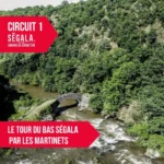
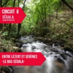
Randonnée – La Bessière et le pont de Vézis – Le Bas Ségala
Description
English
Deutsch
Dutch
Español
Italiano
Description
Circuit SP2 "La Bessière-le pont de Vézis" du livret Balades en Pays Bastidien
Distance: 7 km – Dénivelé positif: 250 m – Durée: 2h
Balisage jaune Les topoguides sont en vente à l'office de tourisme avec les étapes, des informations sur les lieux de visites ainsi que quelques anecdotes historiques.
Retrouvez tous nos circuits sur votre smartphone avec l'application Cirkwi, ou avec un lecteur GPX (ex. GPX viewer) : https://www.cirkwi.com/fr/circuit/1099405-la-bessiere-le-pont-de-vezis
English
Circuit SP2 "La Bessière-le pont de Vézis" from the booklet Balades en Pays Bastidien
Distance: 7 km – Vertical rise: 250 m – Duration: 2h
Yellow markings Topoguides are on sale at the tourist office, with stage directions, information on places to visit and a few historical anecdotes.
Find all our tours on your smartphone with the Cirkwi application, or with a GPX reader (e.g. GPX viewer): https://www.cirkwi.com/fr/circuit/1099405-la-bessiere-le-pont-de-vezis
Deutsch
SP2 "La Bessière-le pont de Vézis" aus dem Buch Balades en Pays Bastidien
Entfernung: 7 km – Positiver Höhenunterschied: 250 m – Dauer: 2 Std
Gelbe Markierung Die Topoguides mit den Etappen, Informationen zu den Sehenswürdigkeiten und einigen historischen Anekdoten sind im Tourismusbüro erhältlich.
Sie können alle unsere Touren auf Ihrem Smartphone mit der Cirkwi-App oder mit einem GPX-Leser (z. B. GPX Viewer) abrufen: https://www.cirkwi.com/fr/circuit/1099405-la-bessiere-le-pont-de-vezis
Dutch
Route SP2 "La Bessière-le pont de Vézis" uit het boekje "Balades en Pays Bastidien
Afstand: 7 km – Verticale stijging: 250 m – Duur: 2 uur
Gele markeringen De topogidsen zijn te koop bij het toeristenbureau, met de etappes, informatie over bezienswaardigheden en enkele historische anekdotes.
Je kunt al onze routes vinden op je smartphone met de applicatie Cirkwi, of met een GPX-lezer (bijv. GPX viewer): https://www.cirkwi.com/fr/circuit/1099405-la-bessiere-le-pont-de-vezis
Español
Ruta SP2 "La Bessière-le pont de Vézis" del folleto "Balades en Pays Bastidien
Distancia: 7 km – Desnivel: 250 m – Duración: 2 horas
Señalización amarilla Las topoguías están a la venta en la oficina de turismo, con las etapas, información sobre los lugares a visitar y algunas anécdotas históricas.
Puede encontrar todas nuestras rutas en su smartphone utilizando la aplicación Cirkwi, o con un lector GPX (por ejemplo, GPX viewer): https://www.cirkwi.com/fr/circuit/1099405-la-bessiere-le-pont-de-vezis
Italiano
Percorso SP2 "La Bessière-le pont de Vézis" dal libretto "Balades en Pays Bastidien
Distanza: 7 km – Dislivello: 250 m – Durata: 2 ore
Segnaletica gialla Le topoguide sono in vendita presso l'ufficio del turismo, con le tappe, le informazioni sui luoghi da visitare e alcuni aneddoti storici.
Potete trovare tutti i nostri percorsi sul vostro smartphone utilizzando l'applicazione Cirkwi, oppure con un lettore GPX (ad esempio GPX viewer): https://www.cirkwi.com/fr/circuit/1099405-la-bessiere-le-pont-de-vezis
Type:
Distance:
départ du parking des Martinets du Lézert à La Bastide l'Evêque, 12200 Le Bas Ségala

Crédits: OFFICE DE TOURISME AVEYRON SEGALA