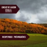
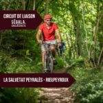
Randonnée – Le Moulin du Bruel – Rieupeyroux
Description
English
Deutsch
Dutch
Español
Italiano
Description
Durée : 1h10 – Distance : 4 km – Dénivelé cumulé 100 m
Départ parking du cinéma – Balisage jaune
Les topoguides sont en vente à l'office de tourisme avec les étapes, des informations sur les lieux de visites ainsi que quelques anecdotes historiques.
Retrouvez tous nos circuits sur votre smartphone avec l'application Cirkwi, ou avec un lecteur GPX (ex. GPX viewer) : https://www.cirkwi.com/fr/circuit/68748-le-moulin-du-bruel 1/ Depuis le parking, passer devant la Poste, prendre la rue du Pitou et continuer tout droit parla rue et la place du gîte vers la route de Carmaux. Juste avant la route, s'engager à droiteentre deux maisons puis suivre à gauche le sentier qui longe un muret point continuer à platpuis emprunter la route à droite sur 150 m.
2/ Dans la forêt, bifurqué à droite sur le chemin qui descend. Arrivé au ruisseau, faire un crochet de 50 m à gauche pour voir la cascade du moulin du Bruel. Revenir sur ses pas e tsuivre le chemin qui longe le ruisseau puis remonte par la Pradarerie et le suc pour arriver à laD612. La prendre sur la droite vers Rieupeyroux.
3/ Après le collège, tourner à droite sur un sentier qui descend au plan d'eau point faire le tour du lac en passant sous le village vacances. En fi n de boucle, sur le bord du lac, le chemin traverse une aire de pique-nique aménagée près de la fontaine Saint-Martial et de l'arboretum(au-dessus). Remonter sur la D612, tourner à droite et remonter par la rue du Balat au parking qui sera sur la gauche.
English
Duration: 1h10 – Distance: 4 km – Total ascent 100 m
Depart from cinema parking lot – Yellow signposting
Topoguides are on sale at the tourist office, with stage directions, information on places to visit and a few historical anecdotes.
Find all our tours on your smartphone with the Cirkwi application, or with a GPX reader (e.g. GPX viewer): https://www.cirkwi.com/fr/circuit/68748-le-moulin-du-bruel 1/ From the parking lot, drive past the post office, take rue du Pitou and continue straight ahead along the street and the gîte square towards route de Carmaux. Just before the road, turn right between two houses, then turn left along a low wall at the point where the path runs flat, then right on the road for 150 m.
2/ In the forest, fork right onto the downhill path. At the stream, take a 50 m detour to the left to see the Moulin du Bruel waterfall. Retrace your steps and follow the path alongside the stream, then up through La Pradarerie and Le Suc to reach the D612. Turn right towards Rieupeyroux.
3/ After the secondary school, turn right onto a path that leads down to the lake and around the lake, passing under the vacation village. At the end of the loop, on the edge of the lake, the path crosses a picnic area near the Saint-Martial fountain and arboretum (above). Return to the D612, turn right and walk up rue du Balat to the parking lot on your left.
Deutsch
Dauer: 1h10 – Entfernung: 4 km – Höhenunterschied insgesamt 100 m
Start Parkplatz des Kinos – Gelbe Markierung
Topoguides mit den Etappen, Informationen zu den Sehenswürdigkeiten und einigen historischen Anekdoten sind im Tourismusbüro erhältlich.
Finden Sie alle unsere Touren auf Ihrem Smartphone mit der Cirkwi-App oder mit einem GPX-Leser (z.B. GPX viewer): https://www.cirkwi.com/fr/circuit/68748-le-moulin-du-bruel 1/ Vom Parkplatz aus gehen Sie am Postamt vorbei, nehmen die Rue du Pitou und gehen geradeaus über die Straße und den Platz des Ferienhauses zur Straße nach Carmaux. Kurz vor der Straße biegen Sie zwischen zwei Häusern rechts ab und folgen dann links dem Weg, der an einer Mauer entlangführt. Danach geht es flach weiter und Sie biegen 150 m rechts auf die Straße ab.
2/ Im Wald zweigen Sie rechts auf den Weg ab, der bergab führt. Am Bach angekommen, schlagen Sie einen 50 m langen Haken nach links, um den Wasserfall der Moulin du Bruel zu sehen. Gehen Sie zurück und folgen Sie dem Weg, der am Bach entlang führt und dann durch La Pradarerie und Le Suc zur D612 aufsteigt. Nehmen Sie die Straße rechts in Richtung Rieupeyroux.
3/ Nach dem Collège biegen Sie rechts auf einen Pfad ab, der zum See hinunterführt. Gehen Sie unterhalb des Feriendorfs um den See herum. Am Ende der Schleife führt der Weg am Seeufer über einen Picknickplatz, der in der Nähe des Brunnens Saint-Martial und des Arboretums (oben) eingerichtet wurde. Gehen Sie auf die D612, biegen Sie rechts ab und gehen Sie die Rue du Balat hinauf zum Parkplatz, der sich auf der linken Seite befindet.
Dutch
Duur: 1u10 – Afstand: 4 km – Totale stijging 100 m
Start vanaf de parkeerplaats van de bioscoop – Gele wegwijzers
Bij het toeristenbureau zijn topogidsen te koop met de etappes, informatie over bezienswaardigheden en enkele historische anekdotes.
Je kunt al onze routes vinden op je smartphone met de applicatie Cirkwi, of met een GPX-lezer (bijv. GPX viewer): https://www.cirkwi.com/fr/circuit/68748-le-moulin-du-bruel 1/ Loop vanaf de parkeerplaats langs het postkantoor, neem de Rue du Pitou en ga rechtdoor langs de straat en de Place du Gîte in de richting van de Route de Carmaux. Vlak voor de weg rechtsaf tussen twee huizen door, dan linksaf langs een laag muurtje op het punt waar het pad vlak loopt, dan rechtsaf langs de weg gedurende 150 m.
2/ Ga in het bos naar rechts het pad op dat bergafwaarts loopt. Maak bij de beek een omweg van 50 m naar links om de waterval van de Moulin du Bruel te zien. Keer terug en volg het pad dat langs de beek loopt en vervolgens omhoog gaat door Pradarerie en Le Suc om de D612 te bereiken. Sla rechtsaf richting Rieupeyroux.
3/ Sla na het college rechtsaf een pad in dat naar beneden naar het meer leidt en om het meer heen, onder het vakantiedorp door. Aan het einde van de lus, aan de rand van het meer, kruist het pad een picknickplaats in de buurt van de fontein Saint-Martial en het arboretum (boven). Keer terug naar de D612, sla rechtsaf en loop de rue du Balat op naar de parkeerplaats aan uw linkerhand.
Español
Duración: 1h10 – Distancia: 4 km – Ascenso total 100 m
Salida desde el aparcamiento del cine – Señalización amarilla
En la oficina de turismo están a la venta topoguías con las etapas, información sobre los lugares a visitar y algunas anécdotas históricas.
Puede encontrar todas nuestras rutas en su smartphone utilizando la aplicación Cirkwi, o con un lector GPX (por ejemplo, GPX viewer): https://www.cirkwi.com/fr/circuit/68748-le-moulin-du-bruel 1/ Desde el aparcamiento, pase por delante de Correos, tome la Rue du Pitou y siga recto por la calle y la Place du Gîte hacia la Route de Carmaux. Justo antes de la carretera, gire a la derecha entre dos casas, luego gire a la izquierda a lo largo de un muro bajo en el punto donde el camino discurre llano y luego a la derecha durante 150 m.
2/ En el bosque, gire a la derecha por el camino que desciende. En el arroyo, tomar un desvío de 50 m a la izquierda para ver la cascada del Moulin du Bruel. Vuelva sobre sus pasos y siga la pista que bordea el arroyo, luego sube por Pradarerie y Le Suc para llegar a la D612. Girar a la derecha en dirección a Rieupeyroux.
3/ Después del colegio, gire a la derecha por un camino que baja hasta el lago y lo rodea, pasando por debajo del pueblo de vacaciones. Al final del bucle, en la orilla del lago, el camino atraviesa una zona de picnic cerca de la fuente Saint-Martial y del arboreto (arriba). Vuelva a la D612, gire a la derecha y suba por la rue du Balat hasta el aparcamiento situado a su izquierda.
Italiano
Durata: 1h10 – Distanza: 4 km – Salita totale 100 m
Partenza dal parcheggio del cinema – Segnaletica gialla
Presso l'ufficio turistico sono in vendita le topoguide con le tappe, le informazioni sui luoghi da visitare e alcuni aneddoti storici.
Potete trovare tutti i nostri percorsi sul vostro smartphone utilizzando l'applicazione Cirkwi, o con un lettore GPX (ad esempio GPX viewer): https://www.cirkwi.com/fr/circuit/68748-le-moulin-du-bruel 1/ Dal parcheggio, passare davanti all'ufficio postale, imboccare la Rue du Pitou e proseguire dritto lungo la strada e la Place du Gîte verso la Route de Carmaux. Poco prima della strada, svoltare a destra tra due case, quindi svoltare a sinistra lungo un muretto nel punto in cui il sentiero si snoda in piano e poi a destra per 150 m.
2/ Nel bosco, imboccare a destra il sentiero in discesa. Al ruscello, fare una deviazione di 50 m a sinistra per vedere la cascata del Moulin du Bruel. Tornate sui vostri passi e seguite il sentiero che costeggia il ruscello e poi sale attraverso Pradarerie e Le Suc fino a raggiungere la D612. Svoltare a destra in direzione di Rieupeyroux.
3/ Dopo il collegio, svoltate a destra su un sentiero che scende al lago e lo aggira, passando sotto il villaggio turistico. Alla fine dell'anello, sul bordo del lago, il sentiero attraversa un'area picnic vicino alla fontana di Saint-Martial e all'arboreto (sopra). Tornare sulla D612, girare a destra e risalire la rue du Balat fino al parcheggio sulla sinistra.
A la campagne
Type:
Distance:
départ sur le parking du cinéma, 12240 Rieupeyroux

Crédits: OFFICE DE TOURISME AVEYRON SEGALA