Acet'eau – rivière soutéraine Champdeniers – Champdeniers
Description
English
Deutsch
Dutch
Español
Italiano
Description
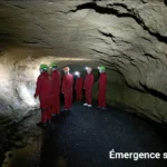
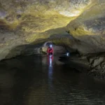
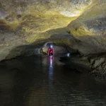
Circuit de la rivière souterraine longue de 4,3 km, accessible par le puits de Chiloup à la Chapelle-Bâton avec descente en rappel et sortie au lavoir de la Roche à St Christophe-sur-Roc. Elle a été découverte en 1975. Cette rivière se situe dans un triangle : st Christophe-sur-Roc/La Chappelle-Bâton/St Projet et est alimentée, d'une part par les eaux de pluie s'infiltrant dans les couches calcaires et d'autre part les eaux de ruissellement se déversent dans les gouffres. L'été, la plupart de ces gouffres ont l'aspect de dolines sèches. Par contre en hivers, leur colmatage important les transforme souvent en mares ou en plans d'eau.
Tenue confortable sport avec bottes ou baskets (vieilles) et tenue intégrale de rechange.
Merci de contacter le Comité Départemental de spéléologie pour les autorisations à l'accès.
English
Circuit of the underground river, 4,3 km long, accessible by the well of Chiloup at la Chapelle-Bâton with abseiling and exit at the wash house of la Roche at St Christophe-sur-Roc. It was discovered in 1975. This river is located in a triangle : St Christophe-sur-Roc/La Chappelle-Bâton/St Projet and is fed, on the one hand, by rainwater infiltrating the limestone layers and, on the other hand, by runoff water flowing into the chasms. In summer, most of these chasms look like dry sinkholes. On the other hand, in winter, their important clogging often transforms them into ponds or water bodies.
Comfortable sportswear with boots or sneakers (old ones) and a change of clothes.
Please contact the Comité Départemental de Spéléologie for access authorizations.
Deutsch
Rundgang durch den 4,3 km langen unterirdischen Fluss, der über den Brunnen Chiloup in La Chapelle-Bâton zugänglich ist, mit Abseilen und Ausstieg am Waschplatz La Roche in St Christophe-sur-Roc. Er wurde 1975 entdeckt. Dieser Fluss liegt in einem Dreieck: st Christophe-sur-Roc/La Chappelle-Bâton/St Projet und wird zum einen durch Regenwasser gespeist, das in die Kalkschichten einsickert, und zum anderen durch Abschwemmungswasser, das in die Abgründe fließt. Im Sommer sehen die meisten dieser Abgründe wie trockene Dolinen aus. Im Winter hingegen verwandeln sie sich durch ihre starke Verstopfung oft in Tümpel oder Wasserflächen.
Bequeme Sportkleidung mit Stiefeln oder Turnschuhen (alt) und Ganzkörperkleidung zum Wechseln.
Bitte wenden Sie sich an das Comité Départemental de Spéléologie, um die Zugangsgenehmigung zu erhalten.
Dutch
Een 4,3 km lang ondergronds riviercircuit, toegankelijk via de put van Chiloup in La Chapelle-Bâton, met abseilen en een uitgang bij het washuis van La Roche in St Christophe-sur-Roc. Het werd ontdekt in 1975. Deze rivier ligt in een driehoek: St Christophe-sur-Roc/La Chappelle-Bâton/St Projet en wordt enerzijds gevoed door regenwater dat infiltreert in de kalksteenlagen en anderzijds door afstromend water dat in de kloven stroomt. In de zomer zien de meeste van deze kloven eruit als droge sinkholes. In de winter veranderen ze echter vaak in vijvers of waterpartijen door hun sterke verstopping.
Comfortabele sportkleding met laarzen of sportschoenen (oude exemplaren) en een kledingwissel voor het hele lichaam.
Neem contact op met het Comité Départemental de Spéléologie voor toegangsrechten.
Español
Circuito fluvial subterráneo de 4,3 km de longitud, accesible a través del pozo Chiloup en La Chapelle-Bâton, con rápel y salida en el lavadero de La Roche en St Christophe-sur-Roc. Se descubrió en 1975. Este río se sitúa en un triángulo: St Christophe-sur-Roc/La Chappelle-Bâton/St Projet y se alimenta, por un lado, del agua de lluvia que se infiltra en las capas calizas y, por otro, del agua de escorrentía que fluye hacia las simas. En verano, la mayoría de estas simas parecen sumideros secos. En invierno, sin embargo, su importante colmatación suele transformarlos en estanques o masas de agua.
Ropa deportiva cómoda con botas o zapatillas (viejas) y una muda de ropa para todo el cuerpo.
Para las autorizaciones de acceso, póngase en contacto con el Comité Départemental de Spéléologie.
Italiano
Un circuito fluviale sotterraneo di 4,3 km, accessibile attraverso il pozzo Chiloup a La Chapelle-Bâton, con discesa in corda doppia e uscita al lavatoio La Roche a St Christophe-sur-Roc. È stato scoperto nel 1975. Questo fiume è situato in un triangolo: St Christophe-sur-Roc/La Chappelle-Bâton/St Projet ed è alimentato, da un lato, dall'acqua piovana che si infiltra negli strati calcarei e, dall'altro, dall'acqua di ruscellamento che scorre nelle voragini. In estate, la maggior parte di queste voragini ha l'aspetto di doline asciutte. In inverno, tuttavia, il loro significativo intasamento li trasforma spesso in stagni o specchi d'acqua.
Abbigliamento sportivo comodo con scarponcini o scarpe da ginnastica (vecchie) e un cambio di indumenti per tutto il corpo.
Per le autorizzazioni di accesso, contattare il Comité Départemental de Spéléologie.
Spéléologie - Dans le village - En bord de fleuve ou rivière
, 79220 Champdeniers