N°7 : De Malitourne à Montplaisir – Beaufay
Description
English
Deutsch
Dutch
Español
Italiano
Description
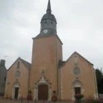
Sur cette terre de trésors (8000 pièces du IIIe siècle découvertes à Beaufay sont exposées au Carré Plantagenêt du Mans), à proximité immédiate de la voie romaine qui reliait Le Mans à Evreux, vous pourrez parcourir des chemins préservés desservant de nombreux hameaux. Aux deux extrémités du circuit, les buttes de Malitourne et de Montplaisir vous réservent de beaux panoramas. Carte et descriptif complet du parcours disponibles sur la fiche rando (disponible à l'Office de Tourisme, la mairie et dans les commerces de Beaufay) et dans le Guide Rando du Perche Sarthois (46 circuits), en vente dans les offices de tourisme du Perche Sarthois au prix de 6€.
English
In this land of treasures (8,000 3rd-century coins discovered at Beaufay are on display at the Carré Plantagenêt in Le Mans), in the immediate vicinity of the Roman road that linked Le Mans to Evreux, you can follow unspoilt paths through numerous hamlets. At either end of the circuit, the buttes of Malitourne and Montplaisir offer stunning panoramic views. Map and full route description available on the "fiche rando" (available from the Tourist Office, Mairie and Beaufay shops) and in the Guide Rando du Perche Sarthois (46 circuits), on sale at Perche Sarthois tourist offices for 6?
Deutsch
In diesem Land der Schätze (8000 Münzen aus dem 3. Jahrhundert, die in Beaufay gefunden wurden, sind im Carré Plantagenêt in Le Mans ausgestellt), in unmittelbarer Nähe der Römerstraße, die Le Mans mit Evreux verband, können Sie auf unberührten Wegen durch zahlreiche Weiler wandern. An beiden Enden der Strecke bieten Ihnen die Hügel Malitourne und Montplaisir schöne Panoramen. Karte und vollständige Beschreibung der Strecke finden Sie auf der Wanderkarte (erhältlich im Fremdenverkehrsamt, im Rathaus und in den Geschäften von Beaufay) und im Wanderführer Perche Sarthois (46 Strecken), der in den Fremdenverkehrsbüros des Perche Sarthois zum Preis von 6 ? erhältlich ist.
Dutch
In dit land van schatten (8.000 munten uit de derde eeuw ontdekt in Beaufay worden tentoongesteld in het Carré Plantagenêt in Le Mans), vlak naast de Romeinse weg die Le Mans met Evreux verbond, kun je ongerepte paden volgen door talrijke gehuchten. Aan beide uiteinden van het circuit bieden de heuvels van Malitourne en Montplaisir een prachtig panoramisch uitzicht. Een kaart en een volledige beschrijving van de route zijn beschikbaar op de wandelkaart (verkrijgbaar bij het Office du Tourisme, de Mairie en de winkels in Beaufay) en in de Guide Rando du Perche Sarthois (46 routes), te koop in de VVV-kantoren van de Perche Sarthois voor 6?
Español
En esta tierra de tesoros (8.000 monedas del siglo III descubiertas en Beaufay se exponen en el Carré Plantagenêt de Le Mans), junto a la calzada romana que unía Le Mans con Evreux, podrá recorrer caminos vírgenes a través de numerosas aldeas. En los extremos del circuito, las colinas de Malitourne y Montplaisir ofrecen unas vistas panorámicas impresionantes. Encontrará un mapa y una descripción completa del recorrido en el mapa de senderismo (disponible en la Oficina de Turismo, el Ayuntamiento y los comercios de Beaufay) y en la Guide Rando du Perche Sarthois (46 itinerarios), a la venta en las oficinas de turismo del Perche Sarthois por 6?
Italiano
In questa terra di tesori (8.000 monete del III secolo scoperte a Beaufay sono esposte al Carré Plantagenêt di Le Mans), proprio accanto alla strada romana che collegava Le Mans a Evreux, si possono percorrere sentieri incontaminati attraverso numerosi borghi. Alle due estremità del circuito, le colline di Malitourne e Montplaisir offrono splendide viste panoramiche. La mappa e la descrizione completa del percorso sono disponibili sulla carta escursionistica (disponibile presso l'Ufficio del Turismo, la Mairie e i negozi di Beaufay) e sulla Guide Rando du Perche Sarthois (46 itinerari), in vendita presso gli uffici turistici del Perche Sarthois al prezzo di 6?
Vtt - Pédestre - Equitation
Type: En boucle
Distance: 22000.0
, 72110 Beaufay