Site d'escalade de Mouriès – Mouriès Sud – Blériotte – Mouriès
Description
English
Deutsch
Dutch
Español
Italiano
Description
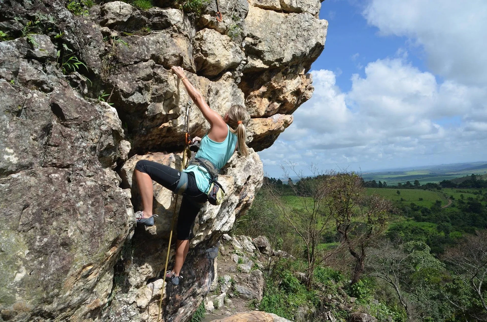
Blériotte, dans le secteur Mouriès Sud, compte 17 voies d'escalade. 1. Blairot – COT 5c
2. Paulo – COT 5c
3. Hachichin – COT 6a
4. Coco Snif – COT 6a+
5. Blériotte – COT 5c
6. Scorpionnibus – COT 6a
7. Equimotage – COT 6a+
8. Bordillos – COT 6b+
9. Dopamine – COT 6b
10. Blairotte – COT 5c+
11. Glumule – COT 6a
12. Blé roté – COT 6a
13. Tricholum terreux – COT 5c+
14. Torpédo – COT 6a
15. Un dimanche à la Campagne – COT 5c+
16. Dernier bal – COT 4b Parkings :
P1 : coordonnées GPS 43.7103, 4.8614
P2 : coordonnées GPS 43.7108, 4.8860 Le Topo "Escalade dans les Alpilles" est disponible dans les Offices de Tourisme Alpilles en Provence (sous réserve de stock disponible). En été, les espaces forestiers sont plus exposés aux risques d'incendies.
Pour protéger promeneurs et sites, l'accès dans les massifs des Bouches-du-Rhône dont les Alpilles est réglementé du 1er juin au 30 septembre.
Les niveaux de dangers sont déterminés quotidiennement par massif forestier. Ils sont consultables à partir de 18h pour le lendemain.
English
Blériotte, in the Mouriès Sud sector, has 17 climbing routes. 1. Blairot – COT 5c
2. Paulo – COT 5c
3. Hachichin – COT 6a
4. Coco Snif – COT 6a+
5. Blériotte – COT 5c
6. Scorpionnibus – COT 6a
7. Equimotage – COT 6a+
8. Bordillos – COT 6b+
9. Dopamine – COT 6b
10. Blairotte – COT 5c+
11. Glumule – COT 6a
12. Blé roté – COT 6a
13. Tricholum terreux – COT 5c+
14. Torpédo – COT 6a
15. Un dimanche à la Campagne – COT 5c+
16. Dernier bal – COT 4b Car parks:
P1: GPS coordinates 43.7103, 4.8614
P2: GPS coordinates 43.7108, 4.8860 The ‘Escalade dans les Alpilles’ guidebook is available from Alpilles en Provence Tourist Offices (subject to availability). In summer, forest areas are more prone to fire.
To protect walkers and sites, access to the Bouches-du-Rhône mountains, including the Alpilles, is regulated from 1 June to 30 September.
The danger levels are determined daily for each forest area. They can be consulted from 6 p.m. for the following day.
Deutsch
Blériotte im Gebiet Mouriès Sud verfügt über 17 Kletterrouten. 1. Blairot – COT 5c
2. Paulo – COT 5c
3. Hachichin – COT 6a
4. Coco Snif – COT 6a+
5. Blériotte – COT 5c
6. Scorpionnibus – COT 6a
7. Equimotage – COT 6a+
8. Bordillos – COT 6b+
9. Dopamine – COT 6b
10. Blairotte – COT 5c+
11. Glumule – COT 6a
12. Blé roté – COT 6a
13. Tricholum terreux – COT 5c+
14. Torpédo – COT 6a
15. Un dimanche à la Campagne – COT 5c+
16. Dernier bal – COT 4b Parkplätze:
P1: GPS-Koordinaten 43.7103, 4.8614
P2: GPS-Koordinaten 43.7108, 4.8860 Der Wanderführer „Escalade dans les Alpilles” ist in den Tourismusbüros der Alpilles in der Provence erhältlich (solange der Vorrat reicht). Im Sommer sind Waldgebiete einer erhöhten Brandgefahr ausgesetzt.
Zum Schutz der Wanderer und der Natur ist der Zugang zu den Gebirgsmassiven des Departements Bouches-du-Rhône, darunter auch die Alpilles, vom 1. Juni bis zum 30. September reglementiert.
Die Gefahrenstufen werden täglich für jedes Waldgebiet festgelegt. Sie können ab 18 Uhr für den nächsten Tag eingesehen werden.
Dutch
Blériotte, in de sector Mouriès Sud, heeft 17 klimroutes. 1. Blairot – COT 5c
2. Paulo – COT 5c
3. Hachichin – COT 6a
4. Coco Snif – COT 6a+
5. Bosmarmot – TOC 5c
6. Schorpioenbus – COT 6a
7. Equimotage – COT 6a+
8. Bordillos – COT 6b+
9. Dopamine – COT 6b
10. Blairotte – COT 5c+
11. Glumule – COT 6a
12. Boekweit – TOC 6a
13. Aardse Tricholum – COT 5c+
14. Torpedo – TOC 6a
15. Een zondag op het platteland – COT 5c+
16. Laatste bal – COT 4b Parkings :
P1: GPS coördinaten 43.7103, 4.8614
P2: GPS coördinaten 43.7108, 4.8860 De gids "Klimmen in de Alpilles" is verkrijgbaar bij de toeristenbureaus van de Alpilles en Provence (zolang de voorraad strekt). In de zomer zijn de bosgebieden meer blootgesteld aan brandgevaar.
Om wandelaars en bezienswaardigheden te beschermen, is de toegang tot de massieven van de Bouches-du-Rhône, inclusief de Alpilles, gereglementeerd van 1 juni tot 30 september.
Voor elk bosgebied worden dagelijks de gevarenniveaus bepaald. Deze kunnen vanaf 18.00 uur voor de volgende dag worden geraadpleegd.
Español
Blériotte, en el sector Mouriès Sud, cuenta con 17 vías de escalada. 1. Blairot – COT 5c
2. Paulo – COT 5c
3. Hachichin – COT 6a
4. Coco Snif – COT 6a+
5. Marmota – COT 5c
6. Scorpionnibus – COT 6a
7. Equimotage – COT 6a+
8. Bordillos – COT 6b+
9. Dopamina – COT 6b
10. Blairotte – COT 5c+
11. Glúmulo – COT 6a
12. Alforfón – COT 6a
13. Tricholum terroso – COT 5c+
14. Torpedo – COT 6a
15. Un domingo en el campo – COT 5c+
16. Último baile – COT 4b Aparcamientos :
P1: coordenadas GPS 43.7103, 4.8614
P2: coordenadas GPS 43.7108, 4.8860 La guía "Escalada en los Alpilles" está disponible en las oficinas de turismo de Alpilles en Provence (bajo reserva de disponibilidad). En verano, las zonas forestales están más expuestas al riesgo de incendio.
Para proteger a los senderistas y los parajes, el acceso a los macizos de Bouches-du-Rhône, incluidos los Alpilles, está regulado del 1 de junio al 30 de septiembre.
Los niveles de peligro se determinan diariamente para cada zona forestal. Pueden consultarse a partir de las 18.00 horas para el día siguiente.
Italiano
Blériotte, nel settore Mouriès Sud, conta 17 vie di arrampicata. 1. Blairot – COT 5c
2. Paulo – COT 5c
3. Hachichin – COT 6a
4. Coco Snif – COT 6a+
5. Cricetino – TOC 5c
6. Scorpionnibus – COT 6a
7. Equimotage – COT 6a+
8. Bordillos – COT 6b+
9. Dopamina – COT 6b
10. Blairotte – COT 5c+
11. Glumule – COT 6a
12. Grano saraceno – TOC 6a
13. Tricholum terroso – COT 5c+
14. Torpedo – TOC 6a
15. Una domenica in campagna – COT 5c+
16. L'ultimo ballo – COT 4b Parcheggi :
P1: coordinate GPS 43.7103, 4.8614
P2: coordinate GPS 43.7108, 4.8860 La guida "Arrampicare nelle Alpilles" è disponibile presso gli Uffici del Turismo delle Alpilles en Provence (in base alla disponibilità). In estate, le aree forestali sono più esposte al rischio di incendi.
Per proteggere gli escursionisti e i siti, l'accesso ai massicci delle Bouches-du-Rhône, comprese le Alpilles, è regolamentato dal 1° giugno al 30 settembre.
I livelli di pericolo sono determinati quotidianamente per ogni area forestale. Si possono consultare a partire dalle 18:00 per il giorno successivo.
A la campagne
Clientèle: Sportifs
Equipements: Parking à proximité
Les Caisses de Jean-Jean, 13890 Mouriès
Crédits: Pixabay / Liza Cicuto / 20250919


